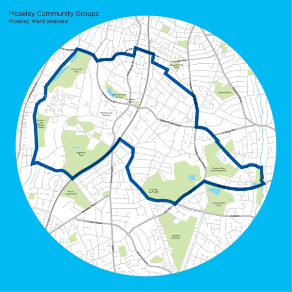
We’ve produced three further images to demonstrate the existing Moseley & King’s Heath Ward, a new Moseley Ward submitted to the Boundary Commission as part of our community response and how Moseley would be split should the Boundary Commission’s draft recommendations proceed.
If you want to see enlarged versions, PDF documents containing the three maps are attached at the bottom of the page.


Printable maps
- Existing Boundary Map (PDF, 289 KB)
- Community Group Map (PDF, 290 KB)
- Boundary Commission Map (PDF,318 KB)
– Submitted by Rob Kewley

